


Garmin Canada Inland Maps | LakeVü g3 Ultra | LVCA100F | microSD™/SD™
$289.99
-
The Premier Freshwater Fishing Map
- Industry-leading coverage, clarity and detail with updated inland maps that feature integrated Garmin and Navionics® content
- Coverage for more than 13,500 total lakes, of which more than 4,800 have up to 1’ contours
- Auto Guidance¹ technology quickly calculates a suggested route by using your desired depth and overhead clearance
- High-resolution relief shading makes it easier to see contours and find fish holding structure
- Depth Range Shading for up to 10 depth ranges enables you to view your target depth at a glance
Experience unparalleled coverage and brilliant detail when you’re on the water. Canada LakeVü g3 Ultra inland maps provide industry-leading coverage, clarity and detail with integrated Garmin and Navionics content.
-
Auto Guidance
Whether you are fishing or cruising, select a spot, and get a route showing you the general path and nearby obstructions at a safe depth¹.High-resolution Relief Shading
The high-resolution relief shading feature adds visual depth to the 2-D map, making it easier to interpret contours and find fish holding structure.Depth Range Shading
This feature displays high-resolution Depth Range Shading for up to 10 depth ranges so you can view your designated target depth.Shallow Water Shading
To give a clear picture of shallow waters to avoid, this feature allows for shading at a user-defined depth.Dynamic Lake Level
This feature allows you to adjust your maps to the lake’s current water levels, giving you a better idea of spots that are either accessible or too shallow to exploreFishEye View
This underwater perspective shows 3-D representation of lake bottom and contours as seen from below the waterline. Interface with sonar data for a customized view.MarinerEye View
This view provides a 3-D representation of the surrounding area both above and below the waterline.Access Your Charts and Maps
Download the ActiveCaptain® app to use OneChart™, which gives you access to all your charts and maps from your mobile device and even lets you purchase new ones. -
Customers who viewed this item also viewed
-
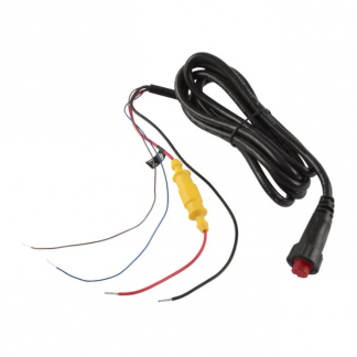
Garmin – Threaded Power/Data Cable (4-pin)
$39.99 Add to cart -
Garmin LiveScope™ Plus Ice Fishing Kit | With LiveScope™ Plus System and Lead Acid Battery
$2,929.99 Add to cart -
Lowrance Portable Power Pack (7/5-Inch Displays)
$390.99 Add to cart -
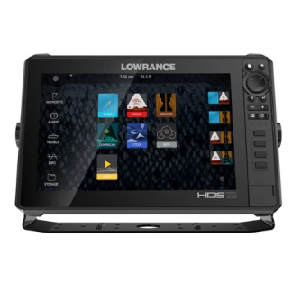
Lowrance HDS-12 LIVE with Active Imaging 3-in-1
$4,485.99 Add to cart