
Lowrance C-MAP® REVEAL™ – Canada Lakes
$399.99
-
The premium mapping solution for cruisers, anglers and sailors looking for accurate, quality data with game-changing shaded relief from the market-leader. Cruising, fishing or sailing, C-MAP® REVEAL™ Lakes charts offer the very best of C-MAP. With Shaded Relief, including game-changing Reveal Seafloor Imagery, Aerial Photography and Satellite Overlay presentation added to the core C-MAP features found in DISCOVER™ – full-featured Vector Charts, with Custom Depth Shading and subscription-free Easy Routing™. It also includes the very best of C-MAP High-Res Bathy, including integrated Genesis® data. Purchase includes a full 12 months of online updates.Compatible with Lowrance, Simrad & B&G Chartplotters.
In the Box:
- Reveal - Canada Lakes
- Ecofriendly Packaging Reveal_Lakes-Us
- Ecopack Sticker For EAN Barcode
- SD Max N+ Sticker
-
Key Features
- Shaded Relief – bring the world around you to life, with 3D rendered land and underwater elevation – including areas of Ultra-High-Res Bathymetric imagery – a game-changer for anglers and divers.
- Full-Featured Vector Charts – making navigation easy by giving you accurate, up-to-date vector chart detail derived from official Hydrographic Office information.
- High-Res Bathy – helps you identify shallow areas, drop-offs, ledges, holes or humps. Now includes compiled and quality-controlled Genesis® detail as part of singular HRB layer.
- Custom Depth Shading – set a clear safety depth, maintain a paper-like view or create your own custom shading.
- Easy Routing™ – helps you automatically plot the shortest, safest route based on detailed chart data and your personalized vessel information.
- Aerial Photography – a collection of thousands of photos of marinas, harbors, inlets and other notable navigational features included to offer an additional level of detail.
- Satellite Overlay – satellite imagery gives information about the surroundings when you find yourself in an unfamiliar place.
- Harbor & Approach Details – unprecedented level of detail. Approach any harbor and inlet with confidence.
- Online Updates – keep your chart up to date, with 12 months’ free online updates.
-
Customers who viewed this item also viewed
-

Garmin GPS 24xd | NMEA 2000®
$539.99 Add to cart -

SCOTTY 2125 12V Downrigger Plug and Receptacle from Marinco
$62.99 Add to cart -
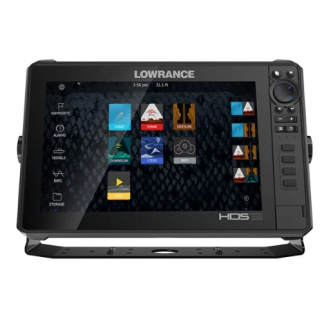
Lowrance HDS-12 LIVE with Active Imaging 3-in-1
Sale Original price was: $4,485.99.$3,588.79Current price is: $3,588.79. Add to cart -
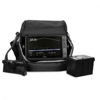
Garmin LiveScope™ Plus Lithium-ion Ice Fishing Bundle | UHD2 ivs 34
$4,449.99 Add to cart